Technology at the service of culture and heritage
Scanners
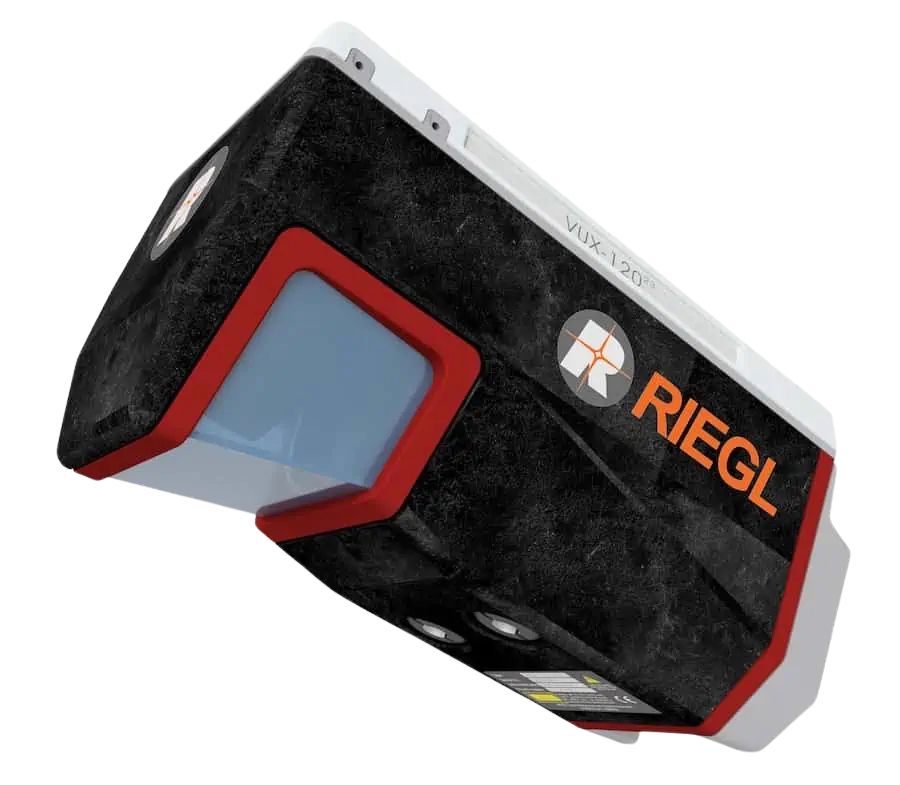 Riegl VUX-120²³ UAV LiDAR Scanner
Through LidArc, we have access to two Riegl VUX-120²³ aerial lidar systems, which represent cutting-edge UAV-based LiDAR technology specifically suited for archaeological and heritage site documentation. Its exceptional 2.4 MHz pulse repetition rate delivers up to 2 million measurements per second, creating ultra-dense point clouds essential for detecting subtle archaeological features. The scanner’s innovative NFB (Nadir/Forward/Backward) scanning pattern alternates between vertical, +10° forward, and -10° backward orientations, ensuring comprehensive data capture of vertical surfaces, facades, and narrow archaeological features that traditional nadir-only systems miss.
With a 100-degree field of view and multi-target capability processing up to 32 returns per pulse, the VUX-120²³ excels at penetrating dense vegetation covering archaeological sites. For heritage applications, the VUX-120²³’s rapid data acquisition – covering large sites in minutes rather than days – proves invaluable for emergency documentation of threatened sites, monitoring erosion at coastal archaeological locations, and systematic regional surveys.
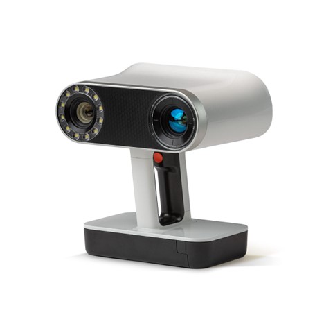
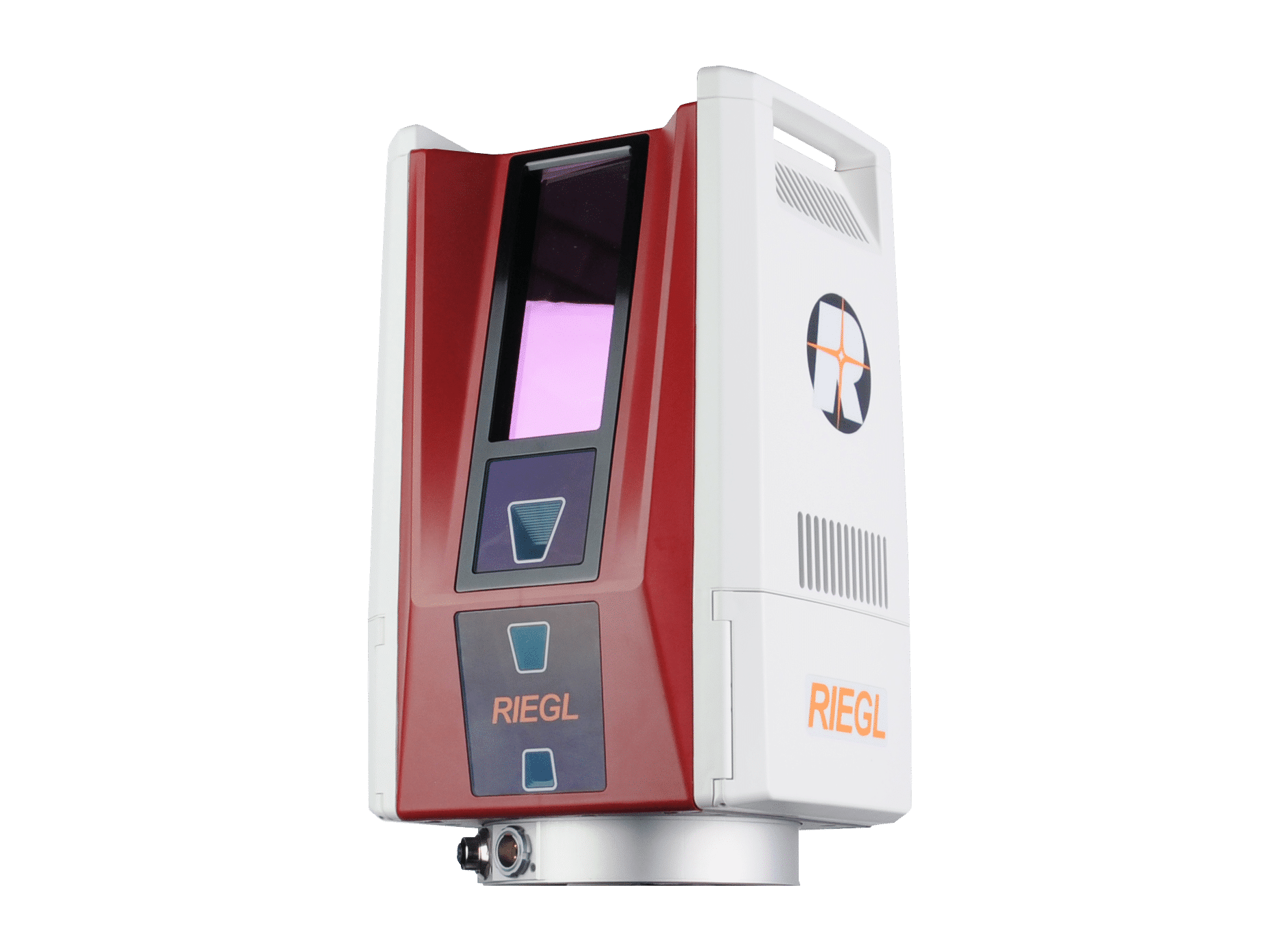 Riegl VZ-600i Terrestrial Laser Scanner
GDH uses two Riegl VZ-600i, which employ time-of-flight laser technology with a 2.2 MHz pulse repetition rate, delivering exceptional data density crucial for heritage documentation. Its 3mm accuracy at 50m range ensures precise capture of architectural details, surface textures, and archaeological features that define cultural heritage sites. The scanner achieves 6mm point spacing at 10m distance in just 30 seconds, producing dense point clouds essential for documenting intricate stonework, decorative elements, and structural conditions.
The integrated RTK-GNSS receiver and IMU sensors provide georeferenced data critical for multi-temporal monitoring of heritage sites and integration with existing GIS databases. Three calibrated cameras capture high-resolution imagery synchronized with scan data, enabling photorealistic texturing of 3D models and orthophoto generation for condition mapping.
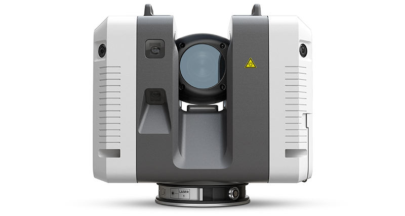 Leica RTC 360
The Leica RTC 360 is a highly portable terrestrial laser scanner designed for maximum productivity and portability. The RTC 360 is capable of collecting 2 million points per second with a maximum scanning range of 130 meters. This scanner is highly accurate with a ranging error of less than 0.4mm at 10 meters. Additionally, the RTC 360 has an integrated HDR camera system capable of producing high resolution spherical images used to colorize captured scan data. Data collected by the RTC 360 is aligned automatically using a Visual Inertial System that tracks the movement of the scanner in the scanning environment and registers scans in real-time. This scanner is an excellent choice for documenting cultural heritage worldwide due to is compact size and light weight. Global Digital Heritage currently has two Leica RTC 360 scanners.
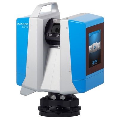 Z+F Imager 5016
The Z+F Imager 5016 is a high-resolution portable terrestrial 3D laser scanner designed to collect highly accurate and extremely dense point clouds at a range of up to 300 meters. This scanner is equipped with an integrated HD camera and lighting system that allows for fast color capture even in difficult lighting conditions. Additionally this scanner is also equipped with an internal positioning system that provides real-time alignment of scans. The data collected with the Z+F Imager 5016 is often merged with terrestrial and drone images to product highly detailed mesh models of structures and large features.
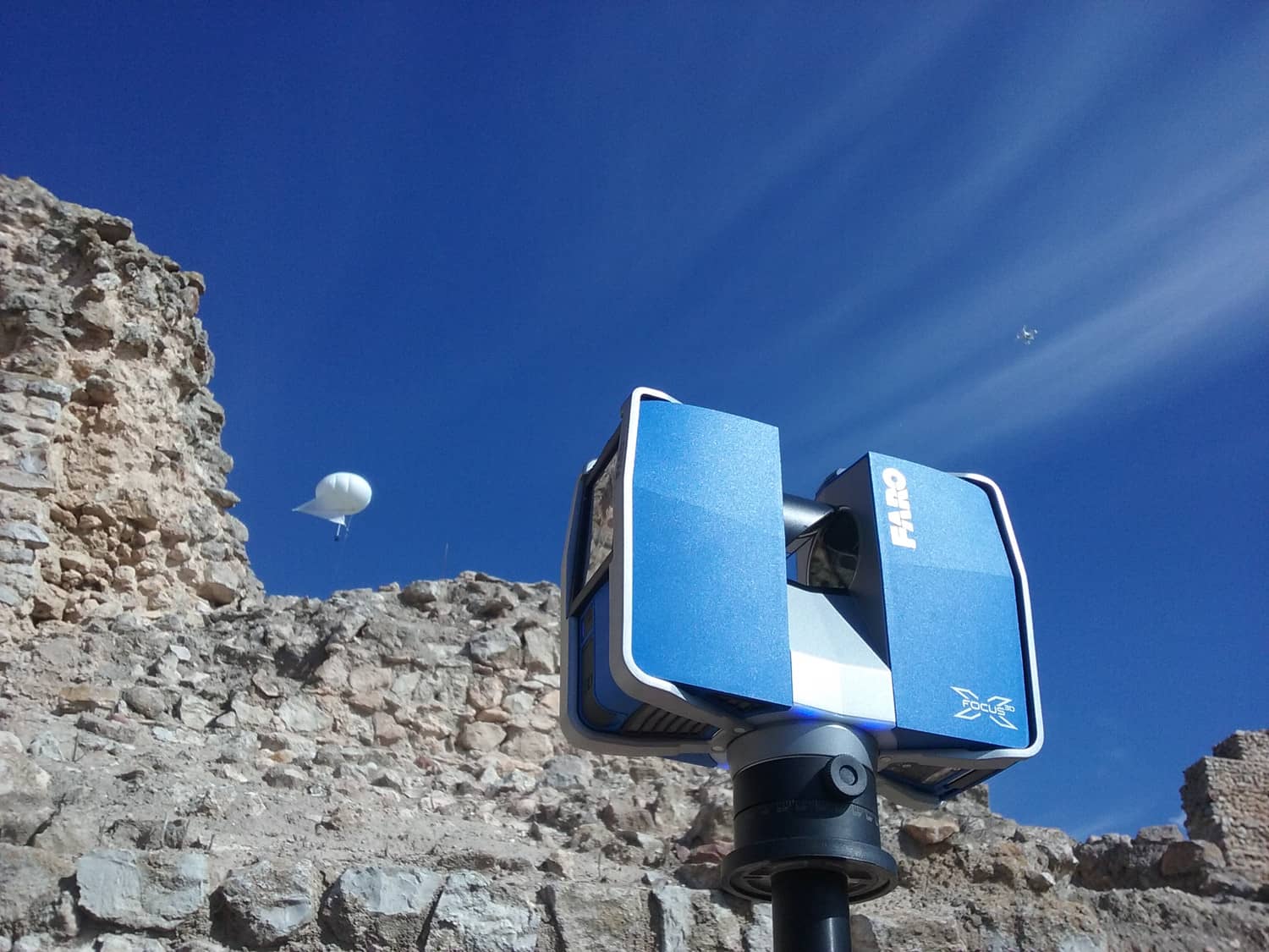
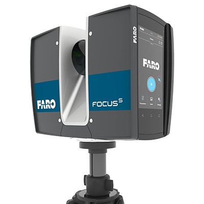 FARO Focus S70
The FARO Focuss 70 is a portable and high-speed phase-shift 3D terrestrial laser scanner designed to capture detailed and highly accurate point cloud datasets of complex objects, environments, and buildings. The Focuss 70 scanner is capable of capturing measurement data at a range of 70 meters and can collect up to 976,000 points per second with an accuracy of up to 1mm. The scanner is equipped with an 8-megapixel HDR camera to capture color imagery that can be merged with the scan data. The point cloud data captured with this scanner can be used in conjunction with multiple 3D software applications to generate a variety of products including, 3D animations and meshes, scaled imagery, CAD-based 2D and 3D digital drawings, and others. GDH uses two Faro Focuss 70 scanners
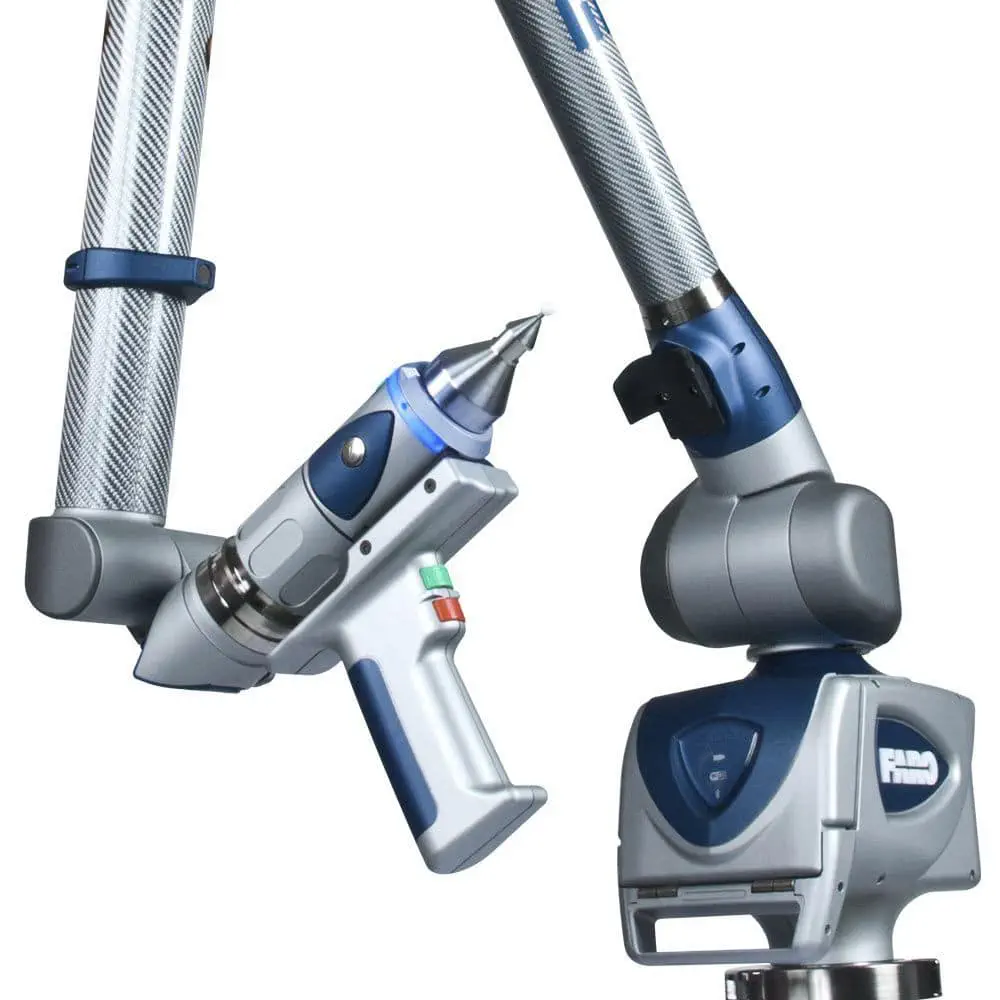 FARO 8-axis Design ScanArm and FARO PRIZM Laser Line Probe
The FARO 8-axis Design ScanArm and FARO PRIZM laser line probe is a portable 3D scanning system with a scan rate of up to 500,000 points per second, and an accuracy measurement of 75 microns. This scanning system is capable of quickly collecting high-resolution point data in full color useful for creating accurate 3D models, reverse engineering, 3D printing, and Rapid Prototyping. The eighth axis of this scanning system is a turntable that improves both alignments and scanning speed. The data captured with the FARO Design ScanArm is compatible with a variety of 3D software applications that can be used to generate 3D meshes and animations, 3D renders, and other project-related products
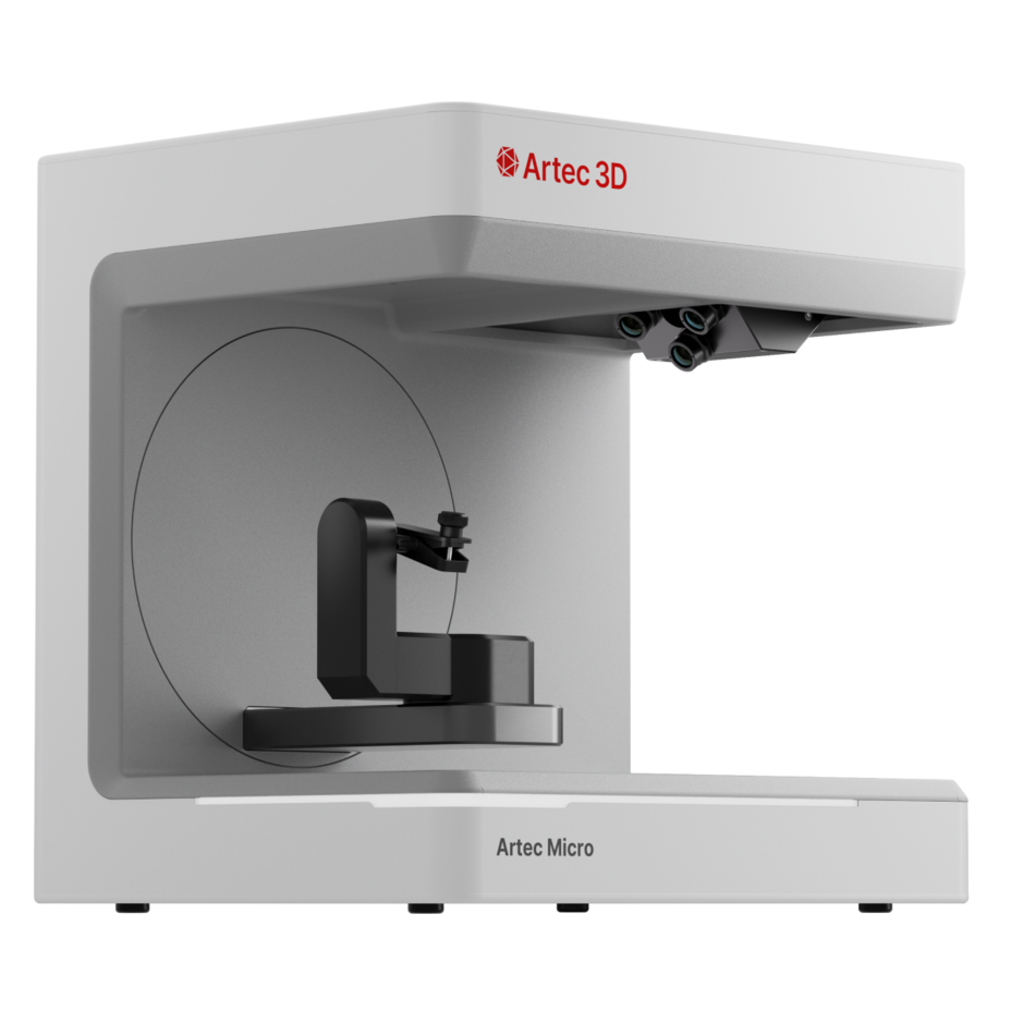 Artec Micro II
Equipped with even greater accuracy, a larger field of view, and the same compact form as its predecessor, the fully automated desktop 3D scanner Micro II allows users to make professional reverse engineering and quality inspection effortless. Activated by a simple click of a button, this 3D scanner for small objects provides a stringent 5-micron accuracy to create highly precise, full-color 3D models of industrial parts, dental, and jewelry. Or, combine scans with photogrammetry data to take hyper-realism to a whole new level, right on your desktop.
 Artec Leo
The Artec Leo is a portable, wireless structured light 3D scanner designed to capture smaller to mid-sized objects in high resolution and detail. The scanner has an accuracy of up to 0.1mm and resolution of up to 0.2mm and captures full color as well as precise geometry. An integrated touch-screen component allows for a live visual of 3D data collection and its wireless, battery-powered configuration permits for flexible, untethered usage. The data captured with the Artec Leo is compatible with a variety of 3D software applications that can be used to generate 3D meshes and CAD drawings, 3D renders, and other project-related products.
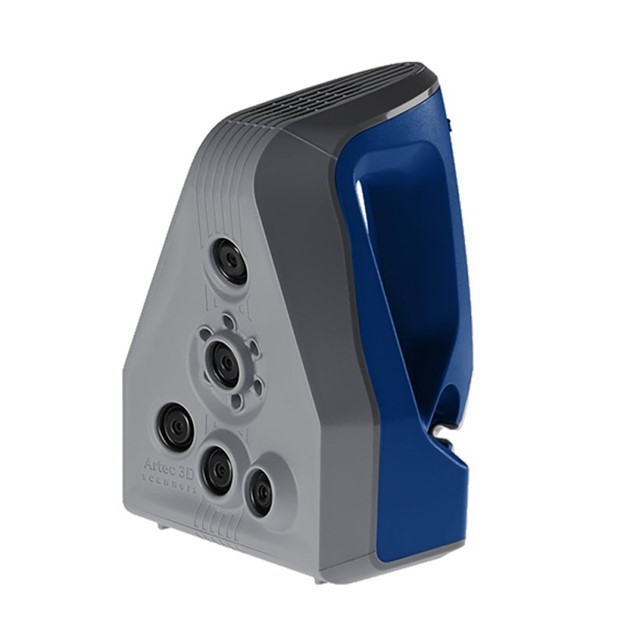 Artec Space Spider
The Artec Space Spider is a portable and metrology-grade structured light 3D scanner ideal for the accurate and high-resolution 3D documentation of small objects with intricate details. The scanner has an accuracy of up to 0.05mm and resolution of up to 0.1mm and captures full color as well as precise geometry. The Space Spider is designed to be hand-held but can also be affixed to tripod for data capture and can work in conjunction with a portable, lightweight turntable. The data captured with the Artec Space Spider is compatible with a variety of 3D software applications that can be used to generate 3D meshes and CAD drawings, 3D renders, and other project-related products.
Photogrammetry and photography
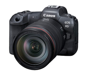 Canon R5
GDH employs 10 Canon R5 kits. The Canon EOS R5 delivers exceptional capabilities for heritage documentation with its 45-megapixel full-frame CMOS sensor, producing 8192×5464 pixel images ideal for capturing intricate architectural details and artifacts. The DIGIC X processor enables ISO 100-51200 sensitivity, crucial for low-light museum environments. Its groundbreaking 5-axis in-body image stabilization provides up to 8 stops of shake reduction, enabling handheld documentation in challenging conditions. The Dual Pixel CMOS AF II system covers 100% of the frame with 1,053 AF zones, ensuring precise focus on detailed surfaces. The camera’s IBIS High Resolution mode creates 400-megapixel files in-camera, perfect for art reproduction and detailed facade documentation where maximum resolution is essential.
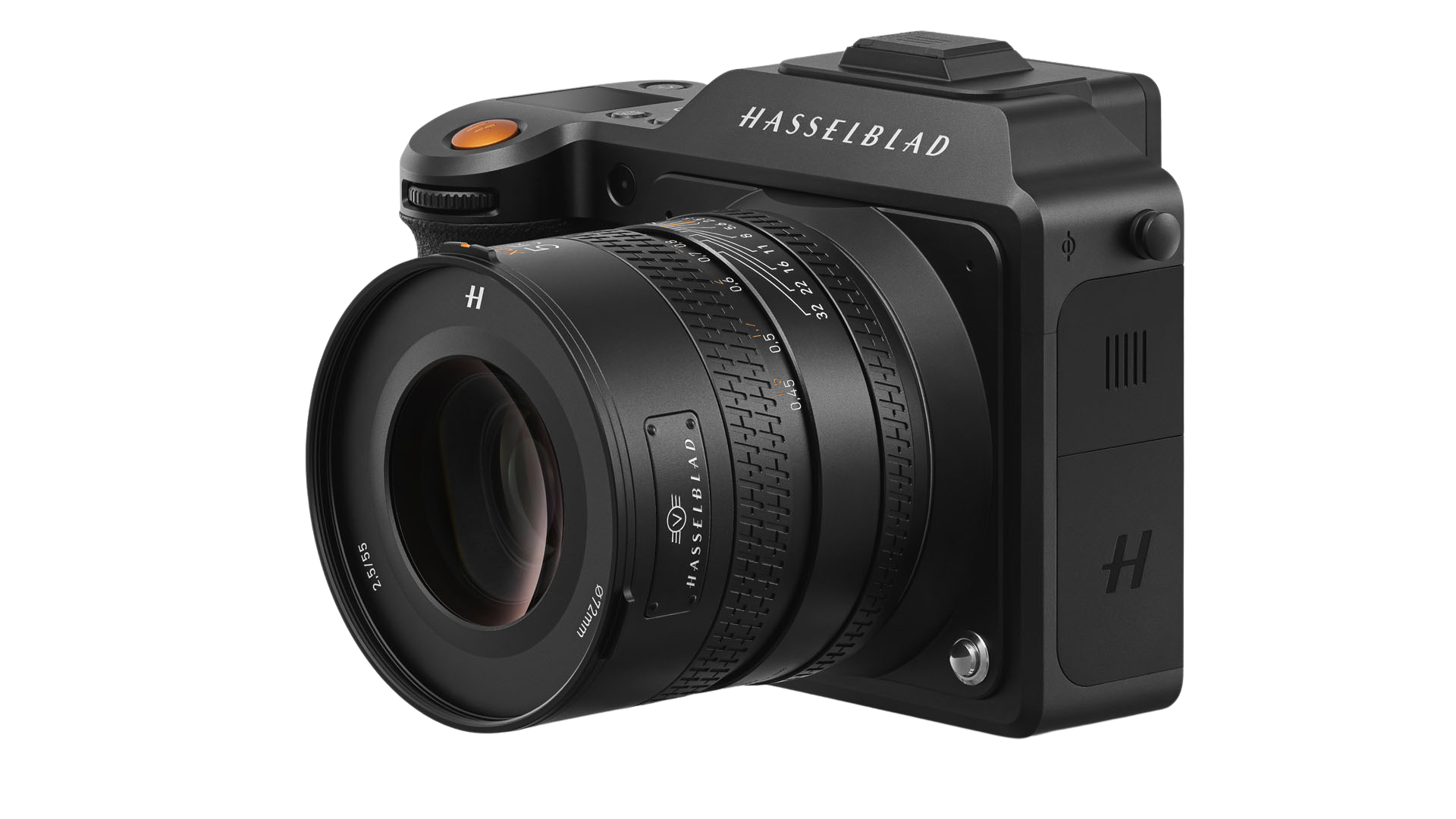 Hasselblad X2D 100C
The Hasselblad X2D 100C delivers exceptional image quality with its 100-megapixel BSI CMOS medium format sensor (43.8×32.9mm), capturing 16-bit RAW files with 281 trillion colors and 15 stops dynamic range. Its 5-axis 7-stop IBIS ensures sharp handheld captures crucial for documenting inaccessible heritage features. The built-in 1TB SSD accommodates extensive documentation sessions, storing 3FR RAW files averaging 206MB each. Leaf shutter technology enables 1/4000s flash sync for artifact photography under mixed lighting. The Hasselblad Natural Color Solution ensures accurate color reproduction essential for heritage documentation, while ISO 64-25600 range handles varied lighting conditions from dark interiors to bright facades with remarkable detail preservation.
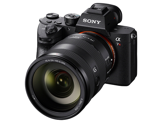 Sony Alpha 7RIV, 7RIII, 7III
GDH also uses the Sony a7RIV, the a7RIII and the Sony a7III. At 60, 45 and 24 mpx, these state-of-the-art mirrorless full-frames cameras provide considerable versatility in a range of environmental conditions.
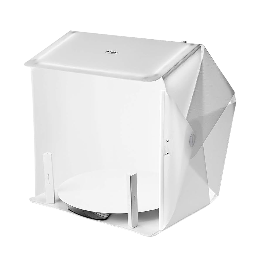 Orangemonkie Foldio360 System
GDH uses 12 Foldio 360 kits around the world. The Foldio360 Smart Turntable system enables precise 360-degree documentation of cultural heritage artifacts weighing up to 11 pounds (5kg). Its Halo Edge LED lighting system provides consistent 5700K daylight illumination, eliminating harsh shadows and creating seamless white backgrounds essential for artifact photography. The turntable connects via Bluetooth to smartphones or IR to DSLR cameras, automatically capturing 24, 36, or 48 frames per rotation through the Foldio360 app. This automated workflow ensures consistent image spacing. The system’s compact design makes it perfect for documenting small to medium artifacts, jewelry, pottery, and archaeological finds with professional results. They are fast, portable, and inexpensive.
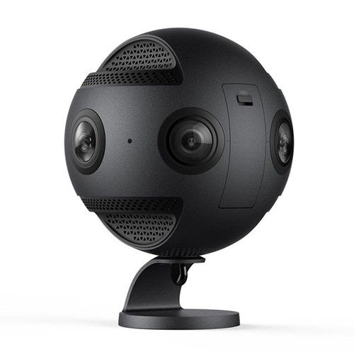 Insta360 Pro
The Insta360 Pro VR camera uses six 200° fisheye lenses to produce professional quality 360-degree immersive spherical images and video. This camera can capture immersive video at a resolution of 8k at 30fps, or 4k at a rate of 100fps, and 3D video at a resolution of 6k at a rate of 30fps. Still images are captured at a resolution of 8k in RAW and JPEG format with the added ability to use the HDR mode for maximum image detail and quality. The Insta360 Pro also features four integrated microphones to capture 360-degree spherical sound, and real-time image stabilization allowing the ability to live-stream smooth steady 2D and 3D video. The images and video produced by this camera are used to create online tours and VR content for our projects. GDH owns two of these cameras and they are employed in a wide variety of settings.
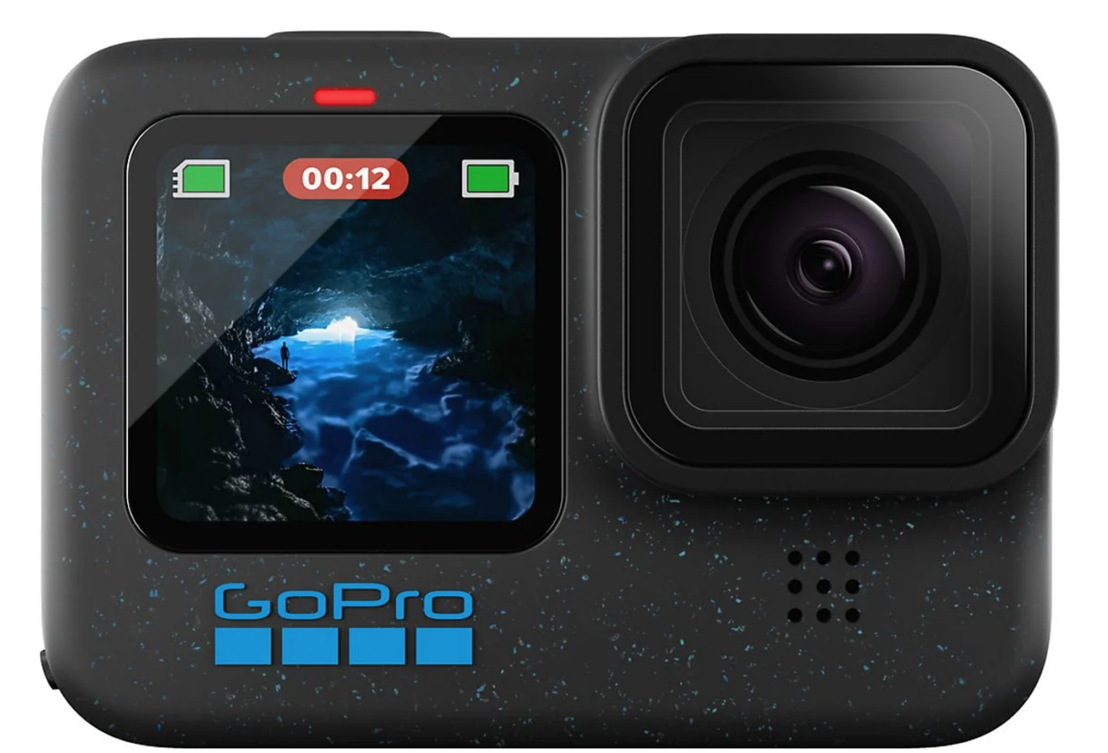 GoPro Hero 12
GoPro Hero 12 action cameras are used extensively on projects to document fieldwork and to produce website and social media content. The Hero 12 is small, lightweight, rugged, and waterproof making it an excellent choice for a wide variety of tough environmental conditions. This versatile GPS equipped camera is capable of capturing 4k resolution video, RAW and JPEG still images, and time lapse video.
Aerial photogrammetry and imaging
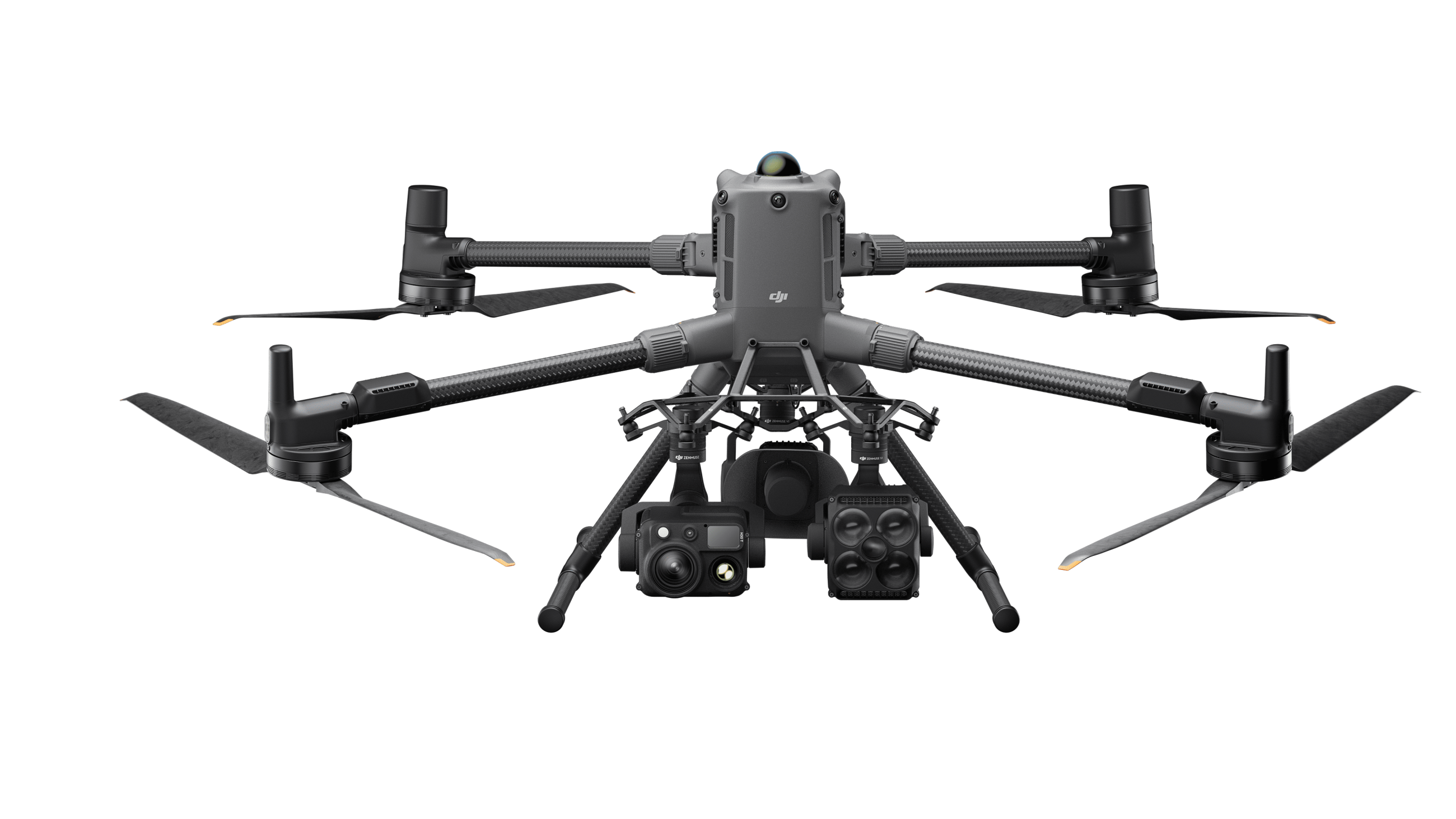 DJI Matrice 400 Enterprise Drone
The Riegl VUX-120²³s are flown by the new DJI Matrice 400, which represents a significant advancement in enterprise UAV technology, offering exceptional capabilities for cultural heritage documentation. Its remarkable 59-minute flight time and 6kg payload capacity enable extensive site coverage in single missions. The platform supports up to seven payloads simultaneously, including the Zenmuse P1 photogrammetry camera and L2 LiDAR scanner, facilitating comprehensive multi-sensor documentation workflows.
The integrated rotating LiDAR system and six-directional mmWave radar provide power-line-level obstacle sensing, crucial for navigating complex archaeological sites and historic structures. With IP55 weatherproofing, the M400 operates reliably in challenging environmental conditions. The O4 Enterprise transmission system extends operational range to 40km, while Real-Time Terrain Following maintains consistent altitude over uneven archaeological landscapes. Smart Detection capabilities automatically identify structures and vehicles, streamlining site surveys. At 21 pounds, this flagship platform balances robust construction with field portability, making it ideal for documenting remote heritage sites requiring extended flight operations and multiple sensor deployments.
 DJI Mavic 3 Enterprise
The DJI Mavic 3 Enterprise in an excellent UAV for mapping and imaging heritage sites due to its portability, impressive flight times, and versatility. This commercial grade UAV is designed for surveying and mapping without the need for ground control points using an integrated RTK GPS system for collecting data with centimeter-level precision. Dual cameras on the M3E include a 4/3” CMOS 20 megapixel wide angle camera with mechanical shutter and a ½” CMOS 12 megapixel tele zoom (7x-56X) camera allowing for the capture of both high quality and high resolution images and video. The compact size of this UAV allows it to be used in areas not able to be accessed by larger drones.
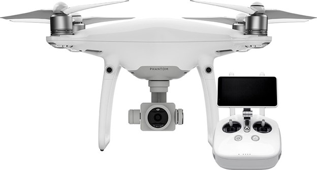 DJI Phantom 4 Pro Ver. 2
Phantom 4 Pro Ver. 2 is equipped with a 1-inch 20-megapixel sensor capable of shooting 4K/60fps video and Burst Mode stills at 14 fps. The adoption of titanium alloy and magnesium alloy construction increases the rigidity of the airframe and reduces weight, making the Phantom 4 Pro similar in weight to the Phantom 4. The FlightAutonomy system adds dual rear vision sensors and infrared sensing systems for a total of 5-direction of obstacle sensing and 4-direction of obstacle avoidance
Flight Autonomy is expanded with an additional set of high-resolution stereo vision sensors placed at the rear in addition to the pair placed at the front as well as infrared sensing systems placed on the left and right sides.
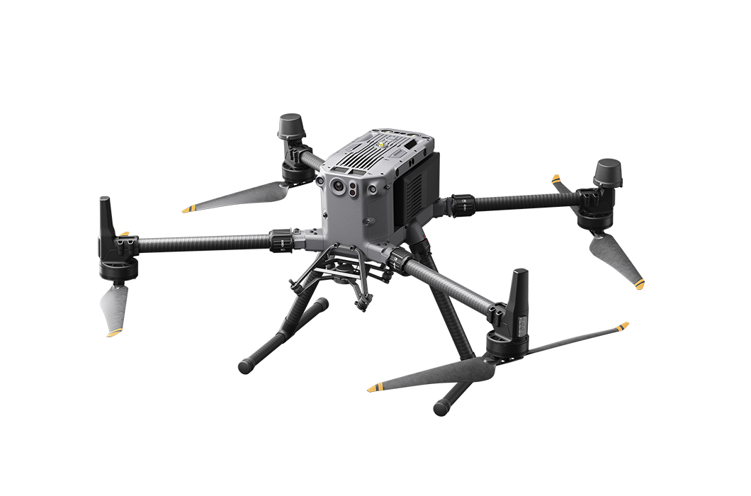 DJI Matrice 350 RTK
The DJI Matrice 350 RTK provides a great deal of flexibility for our large-scale mapping and surveying projects. The Matrice 350 RTK has a maximum payload capacity of 2.7kg making it an excellent choice for flying external sensors like aerial LiDAR systems and external high-resolution cameras. The improved safety capabilities of the Matrice 350 RTK allow this UAV to be deployed in difficult and complex mapping environments. Intelligent features of the Matrice 350 RTK include terrain follow capabilities and smart oblique mapping for highly efficient and precise data collection. The enhanced transmission capabilities of the Matrice 350 RTK provides seamless connectivity for distances of up to 20km which provides another level of safety and efficiency.
 Surveyor 32 Max Lidar
The Surveyor 32 MAX from LIDAR USA is our new lightweight and long-range LiDAR system. Flying at a height of 120 meters and carrying dual integrated 24MP cameras on the DJI m350, this unit will capture up to 600 points per meter.
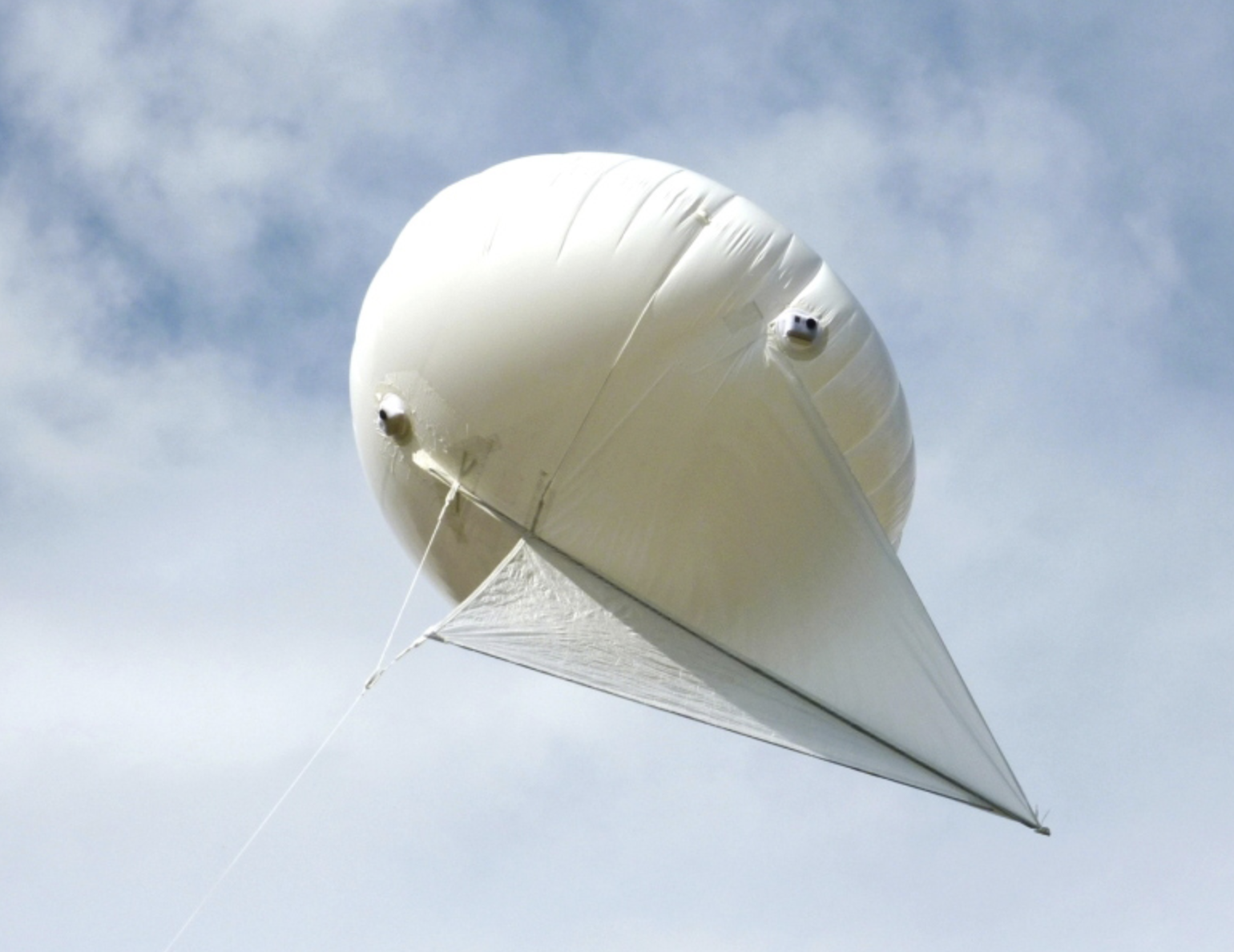 6m3 Skyhook Helikite
Designed to lift considerable payloads to higher altitudes than is possible with any other similar sized aerostats. Skyhook Helikites are able to lift full size DSLR cameras with ease. The gimble and video controller allow for accurate, but tethered, photogrammetric data acquisition. Since the blimp is tethered, there are fewer restrictions for aerial photography in more populated areas.
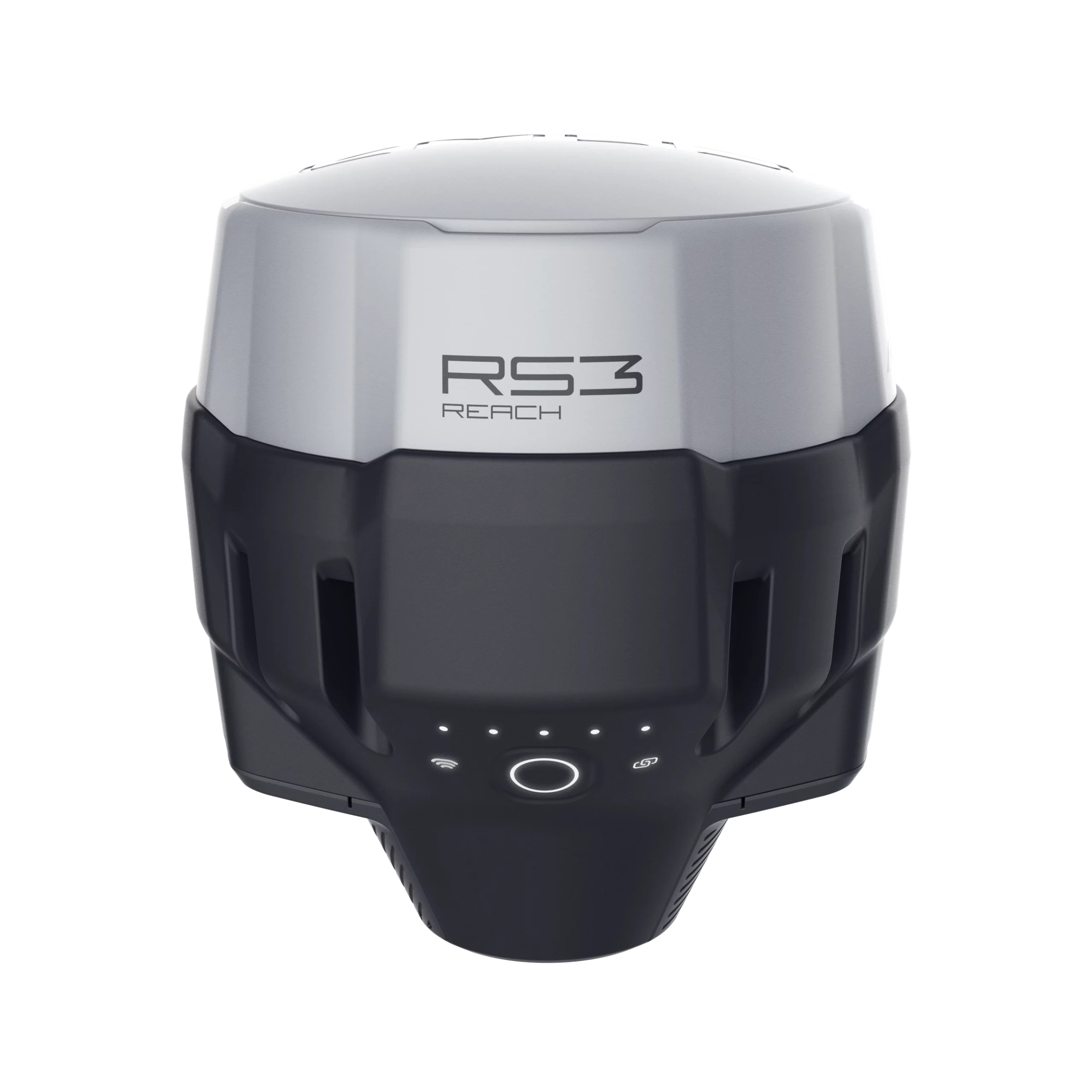 Emild RS3 and Reach X
Our archaeological fieldwork is supported by state-of-the-art GNSS equipment, including the EMILD RS3 and Reach RX. These high-precision tools provide real-time positioning with centimeter-level accuracy, even in challenging environments. This technology allows us to document sites with maximum efficiency and reliability, ensuring the highest standards in heritage research and preservation.
 Trimble Geo 7x
GDH uses a Trimble Geo 7x centimeter –level GNSS receiver with an external Zephyr 3 Antenna for recording drone and laser scanner Ground Control Points (GCPs) and also for general GIS mapping for documentation purposes. In Spain we use Virtual Reference Station (VRS) networks provided free of charge by the Instituto Geográfico Nacional for real-time data correction which typically provides a horizontal accuracy of 2cm and a vertical accuracy of 3cm. Control and GIS data are imported and post-processed in Trimble Pathfinder Office (PFO). Typically, these data are exported from PFO in ESRI Shapefile format in UTM coordinates and as Google Earth KMZs in WGS Lat/Long.
Visualization
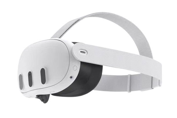 Meta Quest 3
The Meta Quest 3 stands out as a top-tier virtual reality (VR) headset. Its sleek, standalone design eliminates the need for an external computer or console, ensuring maximum accessibility. Boasting a high-resolution display and a powerful processor, it delivers a premium VR experience. Additionally, a vast library of applications empowers users to explore virtual realms, indulge in multimedia content, and fully immerse themselves in interactive adventures. With exceptional comfort, user-friendliness, and an attractive price point, the Meta Quest 3 emerges as the preferred choice for those eager to venture into the exciting realm of virtual reality.
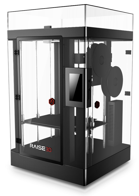 Raise3D N2 Plus
The Raise3D N2 Plus is a large build capacity FDM 3D printer that is capable of producing highly detailed prints from a wide variety of supported filaments. The large build capacity allows this printer to handle large printing jobs, but also small detailed prints due to its 0.4mm nozzle. The proprietary slicing software and integrated touchscreen interface of the N2 Plus makes uploading files and making printer adjustments straightforward. These features make the Raise3D N2 Plus an ideal printer for our printing and outreach needs.
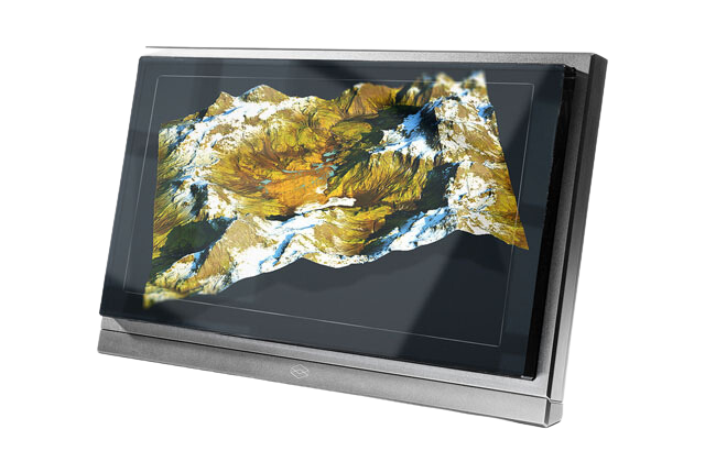 Looking Glass Pro
The Looking Glass Pro is a holographic display that is designed to be a complete 3D visualization solution. The 15.6” touchscreen display allows users to interact with spatial data without the need for VR or AR headsets. The Looking Glass Pro provides a more active visualization than most conventional holographic displays since it utilizes Leap Motion hand-tracking technology. This technology allows users to manipulate and virtually touch 3D data in a realistic manner. Additionally, being that the Looking Glass Pro is an all-in-one solution and portable, it can be setup anywhere with a power source making it an excellent way to share digital heritage with the public.
Software
- 3D Coat
- Adobe Creative Suite
- Agisoft Metashape
- ArcGIS
- Arena4D
- Autocad
- BentleyPointools
- Blender
- CloudCompare
- DaVinci Resolve 14
- DXO Photolab
- FARO Scene
- GoPro VR Viewer
- Geomagic
- GIMP
- Instant Meshes
- Kolor Panotour Pro
- Meshlab
- Meshmixer
- Oculus
- Pix4D
- Prusa Slicer
- QGIS
- Reality Capture
- Simplify3D
- Unreal Engine
- xNormal
- Zbrush