The LidArc Initiative
Revealing the unseen:
A Global Leap Forward in
Archaeological Discovery
About
Map
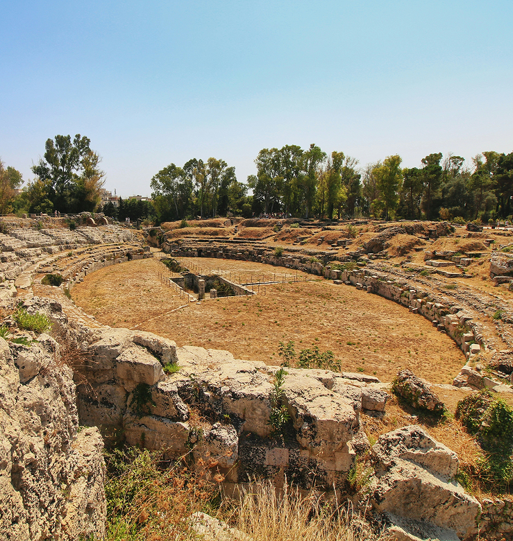
From the rainforests of the Amazon to the hills of Tuscany
The LidArc Initiative covers over 10 countries and thousands of square kilometers of archaeological landscapes—mapped in unprecedented detail
The LidArc Consortium
The LidArc Consortium brings together some of the world’s leading experts in LiDAR and archaeological survey. This diverse team leads the initiative with deep expertise, international collaboration, and decades of field experience.

Herbert Maschner
President and Chief Scientist of Global Digital Heritage, Corresponding Principal Investigator, GDH LidArc Initiative
New Port Richey, FL, USA
Stefano Campana
Principal Investigator Università degli Studi di Siena (UniSI) and Nex-Gen Archaeological Survey Technology (NeXST)
Siena, Italy
Fabio Remondino
Principal Investigator, Fondazione Bruno Kessler (FBK)
Trento, Italy
Marcello Canuto
Principal Investigator, Tulane University (TU), Middle American Research Institute
New Orleans, LA, USA
Thomas Garrison
Principal Investigator, University of Texas at Austin (UTA), Lidar and Landscapes of the Ancient Mediterranean and Americas Laboratory (LLAMA), Department of Geography and the Environment, The University of Texas at Austin
Austin, TX, USA
Francisco Estrada-Belli
Co-Principal Investigator, Tulane University (TU), Middle American Research Institute
New Orleans, LA, USA
Carlos Morales-Aguilar
Co-Principal Investigator, University of Texas at Austin (UTA), Lidar and Landscapes of the Ancient Mediterranean and Americas Laboratory (LLAMA), Department of Geography and the Environment, The University of Texas at Austin
Austin, TX, USA
Michele Nucciotti
Co-Principal Investigator, Universita di Firenze (UniFI), Dipartimento di Storia Archeologia Geografia Arte e Spettacolo (SAGAS)
Firenze, ITALYTechnology and methodology
Our methodology combines cutting-edge aerial LiDAR with high-resolution 3D mapping, ground validation, and close work with local archaeologists and community stakeholders. This hybrid approach enables robust, contextual data that informs both academic research and cultural preservation.
Reach to us: We’re expanding.
Are you working on a region that could benefit from LiDAR survey? Let’s talk.
We actively seek partnerships with archaeologists, heritage institutions, NGOs, indigenous groups, and local governments to bring LidArc to new regions. Media inquiries welcome.
CONTACT
maschner@globaldigitalheritage.org
Media inquiries welcome.
Download our press kit and discover how LidArc is reshaping archaeology from the skies.
PRESS CONTACT
maschner@globaldigitalheritage.org